What is a Cartographer?
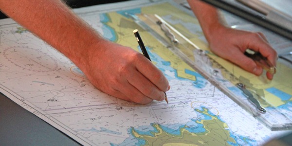
The first maps were manually constructed with brushes and parchment, dating back many centuries. From the 15th to the 17th century, during the Age of Exploration, cartographers used these maps that had been passed down through the centuries to create new ones based on new surveying techniques and explorers' observations.
Today, cartography is a mixture of art, science, and technology. Cartographers use geodetic surveys and remote sensing systems to measure, analyze, and create maps and charts for political, cultural, and educational purposes.
What does a Cartographer do?
Cartographers typically do fieldwork to collect and verify data used in creating maps. They will also:
-
Collect and analyze geographical data, such as population density, demographic characteristics, and annual precipitation patterns
-
Examine and compile data from ground surveys, reports, aerial photographs, and satellite images to prepare thematic maps
-
Prepare thematic maps in digital or graphic form to be used for social, environmental, political, business, educational, and design purposes
-
Revise existing maps and charts to make corrections, adjustments, and updates
Cartographers use information from geodetic surveys and remote sensing systems, including aerial cameras, satellites, and technologies such as light-imaging detection and ranging (LIDAR).
LIDAR uses lasers attached to planes and other equipment to digitally map the topography of the earth. LIDAR is often more accurate than traditional surveying methods and can also be used to collect other forms of data, such as the location and density of forest canopies.
Data from LIDAR is used to provide spatial information to specialists in water resource engineering, geology, seismology, forestry, construction, and other fields.
A cartographic professional who creates maps using geographic information system (GIS) technology is known as a geographic information specialist. A GIS is typically used to assemble, integrate, analyze, and display spatial information in a digital format.
Maps created with GIS technology link spatial graphic features with non-graphic information. These maps are useful for providing support for decisions involving environmental studies, geology, engineering, land-use planning, and business marketing.
A cartographer will also work from existing maps, surveys, and other records. To do so, they must be able to determine thematic and positional accuracy of each feature being mapped. They also make decisions about the accuracy and reliability of the final map.
In addition, they must decide what further information they need to meet the client's needs. They focus on details when including features needed on a final map, and identify and resolve issues with the tools available to them.
What is the workplace of a Cartographer like?
Cartographers spend much of their time in offices using computers with large monitors, so they can easily study and extract information from aerial photographs and other sources.
However, certain jobs require extensive fieldwork to acquire data and verify results. They typically do fieldwork to collect and verify data used in creating maps.
Cartographers are also known as:
Mapmaker
Map Maker
GIS Analyst
Digital Cartographer
Geographic Information Systems Specialist
Geographic Information Specialist