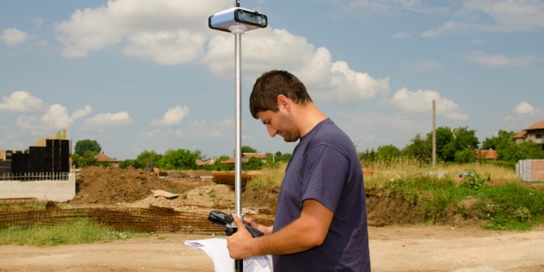
What is a Geodesist?
The earth is growing and changing all the time. Just as a growing child gets measured, the earth too needs to keep track of its changes (for example, measuring changes like melting glaciers and moving plates).
A geodesist is someone who measures and monitors the earth to determine the exact coordinates of any point. They are scientists who use satellite images and on-the-ground surveys to put together a complete picture of the world’s measurements. By using the process of applied mathematics and physics, geodesists use tangible measurements and calculations rather than theory.
This field differs from fields like cartography or geography, as it is primarily concerned with how things that are not visible to the human eye alter the earth’s appearance. GIS technicians and other mapping specialists will use geodesist data for many different applications.
What does a Geodesist do?

Geodesy is the science of measuring and understanding three properties of the earth:
- its geometric shape
- its orientation in space
- its gravity field
The earth is ever-changing, and studying certain aspects of it and its topography is the job of a geodesist. Geodesists survey land to determine precise coordinates of topological features of the earth, take measurements not only on land, but at sea and use powerful telescopes to calculate planetary processes. They use equipment such as remote sensing, and since the invention of satellite technology, they have used a GIS (geographic information system) to calculate distances. By using this method, they have the ability to create detailed mappings of the earth's shape, measurements, and characteristics. They can measure the distance of two points on earth to within approximately 1mm, and are able to track the rise of the mean ocean surface to about 1.7 mm per year.
Geodesists study things that can change the topographical aspects of the earth, such as gravitational pull, tectonic plates, polar activity, and the rotation of the earth. The pull of gravity can be measured with amazing accuracy (detecting changes of one billionth of your body weight). Geodesists also measure distances between multiple points (which include those between earth and other planetary bodies). The information gathered determines things like how quickly a glacier is melting, and whether or not continents are spreading apart. Other scientists will use this type of information to make guesses about how the landscape will change and what the world will look like in a few years.
What is the workplace of a Geodesist like?
The majority of geodesists work in land and planning services as surveyors. They will work with and for architecture services, taking measurements to ensure that buildings or urban plans are constructed on structurally sound surface, in the right places and that the measurements are aligned. They will be familiar with geophysical survey equipment and can work easily alongside these groups of people.
Geodesists are also known as:
Geodetic Surveyor
Engineering Geodesist